PLANNING COMMISSION REPORT
Regular Agenda – Public Hearing Item
ITEM NO. 8B : A & V-C TO GPI; 536.88 ACRES; N 1175 RD & E 1600 RD (MKM)
Z-04-04-07: A request to rezone a tract of land approximately 536.88 acres, from A (Agriculture) and V-C (Valley Channel) to GPI (General Public and Institutional). The property is located at N 1175 Road & E 1600 Road. Submitted by Bartlett & West Engineers, for the City of Lawrence, property owner of record.
|
STAFF RECOMMENDATION: Staff recommends approval of the rezoning request for 536.88 acres from V-C (Valley Channel) and County A (Agricultural) Districts to GPI (General Public and Institutional) District and forwarding it to the City Commission with a recommendation for approval based on the findings of fact found in the body of the staff report and subject to the following condition: 1. Recording of a final plat prior to publication of the rezoning ordinance |
Applicant’s reason for request: “The property is being annexed and rezoned to appropriately fit within the zoning criteria described in the new City of Lawrence Land Development Code for a water reclamation facility.”
KEY POINTS
· The intent of the applicant is to rezone the site to GPI to permit future development as a water reclamation facility.
· The City’s Wastewater Master Plan recommends locating a water reclamation facility south of the Wakarusa River.
· The property is outside the Lawrence city limits. An annexation request was submitted concurrently with this rezoning request and is being considered at this Planning Commission meeting.
GOLDEN FACTORS TO CONSIDER
CHARACTER OF THE AREA
· The property is encumbered with floodplain and floodway. The site has been used for agricultural purposes and has never been developed. The property lies near the intersection of two local roads, and is bounded on two sides by waterways making it an isolated location.
CONFORMANCE WITH HORIZON 2020
§ The proposed rezoning request from V-C (Valley Channel) and A (Agricultural) Districts to GPI (General Public and Institutional) is consistent with land use recommendations found in Horizon 2020.
ASSOCIATED CASES/OTHER ACTION REQUIRED
· Applications being considered at the May Planning Commission:
· Annexation request [A-04-02-07]
· Special Use Permit [SUP-04-04-07]. Sites in the GPI District are required to submit a Institutional Development Plan. Sites less than 10 acres may submit a site plan; sites with more than 10 acres must submit a Special Use Permit.
· Preliminary Plat [PP-04-04-07]
· Board of County Commissioners finding that the annexation will not hinder the orderly growth and development of the community.
· City Commission actions:
· Approval of annexation.
· Acceptance of easements and road right-of-ways as shown on the preliminary plat.
· Final Plat submitted to Planning Office for administrative approval and recordation at the Douglas County Register of Deeds.
· Submittal of Public Improvement Plans to Public Works Department prior to the recording of the final plat.
· Publication of Zoning and Annexation Ordinances.
· Submittal and administrative review of site plan and floodplain development permit for each phase of the development, in conformance with the SUP.
· NPDES permit from the Kansas Department of Health and Environment.
· Dedicated truck route selected by County and City Staff.
· Easements purchased for the laying of the sanitary sewer line, where it is not possible to locate within the road right-of-way.
· Minimum maintenance road designations reversed for N 1175 and E 1600 Roads reversed if they are utilized for access.
PUBLIC COMMENT RECEIVED PRIOR TO PRINTING
· No public comments have been received prior to printing this report.
GENERAL INFORMATION
|
Current Zoning and Land Use:
Surrounding Zoning and Land Use: |
V-C (Valley Channel) and A (Agricultural) Districts and Floodplain Overlay District; Agricultural uses and wooded waterway corridors.
To the west: A (Agricultural) and V-C (Valley Channel) Districts and Floodplain Overlay District; Agricultural uses and scattered rural residences.
To the south: A (Agricultural) District and V-C (Valley Channel) Districts and Floodplain Overlay District; Agricultural uses and scattered rural residences.
To the east: A (Agricultural) District and Floodplain Overlay District; Agricultural uses, wooded areas and scattered rural residences.
To the north: V-C (Valley Channel) District and Floodplain Overlay District; Wakarusa River and agricultural uses.
|
I. ZONING AND LAND USES OF SURROUNDING PROPERTIES
Staff Finding -- The property lies south of the Wakarusa River and west of Coal Creek. The subject property is encumbered with flood plain which extends into the surrounding area, primarily to the south and east. The surrounding property is zoned V-C and A. The predominate land uses in the area are agriculture and scattered rural residences.
II. CHARACTER OF THE AREA
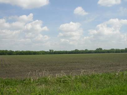
The area is a relatively isolated area which has had limited development to this point. The Wakarusa River and Coal Creek corridors separate the area from the land to the north and east. The location of the river and creek also prevented roads from being extended through this area. This is a relatively isolated area with scattered rural residences. (Figure 1)
Staff Finding -- The area is an isolated rural area with farming activity and scattered rural residences.
III. SUITABILITY OF SUBJECT PROPERTY FOR THE USES TO WHICH IT HAS BEEN RESTRICTED
Applicant’s Response:
“The proposed rezoning is in clear compliance with any land use restrictions or guidelines that could happen inside this proposed zoning district. The granting of this rezoning application in no way opposes the general spirit of the Zoning Ordinance, Subdivision Regulations, or new City of Lawrence Land Development Code.”
The majority of the subject property is currently zoned V-C (Valley Channel) with a small portion zoned A (Agricultural). According to the County Zoning Regulations the primary purpose of the V-C District is to prevent such development as would result in a hazard to health or safety in those areas subject to periodic or potential flooding, and the primary purpose of the A District is to provide for a full range of agricultural activities and to offer protection to agricultural land from the depreciating effect of objectionable, hazardous and unsightly uses. The zoning classifications are currently appropriate for the property as it is county property located within the floodplain. Low impact uses which are permitted in the Agricultural and Valley Channel Zoning Districts are appropriate for this area.
A request has been submitted for the annexation of the property into the City of Lawrence. Rezoning to City Zoning Districts is required with annexation and the applicant is requesting a rezoning to the GPI District.
Per the Development Code, the GPI Districts are intended to accommodate institutional uses occupying significant land areas which are not appropriate for the H (Hospital) District or within properties designated as ‘University’. Horizon 2020 recommends the adoption and implementation of a utility extension policy for Lawrence to guide the sequencing of appropriate future development areas within the UGA. (page 10-11, Horizon 2020). Horizon 2020 addressed the need for a new wastewater treatment plant and suggested two locations, south of the Wakarusa and one east of the city near the Kansas River. The proposed site was selected based in part on recommendations from the City’s Wastewater Master Plan. This master plan indicated the need for a 2nd wastewater treatment plan and recommended a location south of the Wakarusa for the new facility.
Staff Finding -- The property as zoned would allow for agricultural uses and farm residences. This is a suitable use for this property; however this property was selected based on criteria from the City’s Wastewater Master Plan as a site for a future Water Reclamation Facility. This is a suitable use for property which is somewhat isolated, as the negative externalities will be minimized. Upon annexation, the county zoning is no longer applicable.
IV. LENGTH OF TIME SUBJECT PROPERTY HAS REMAINED VACANT AS ZONED
Applicant’s Response:
“”These properties have been outside of the city limits and currently are zoned in the A (Agricultural) and V-C (Valley Channel) district by Douglas County.”
Staff Finding – The property has never been developed but has been used for agricultural purposes.
V. EXTENT TO WHICH REMOVAL OF RESTRICTIONS WILL DETRIMENTALLY AFFECT NEARBY PROPERTY
Applicant’s response:
“No specifically identifiable hardships will be imposed upon individual landowners or the public with the submittal of this rezoning application.”
There are potentially negative impacts associated with a water reclamation facility; primarily odor and increased truck traffic. City and County Staff are working to determine the appropriate dedicated truck route. Truck traffic will primarily occur during construction. Once the plant is in operation, traffic volumes will be low. A relatively isolated site was selected so the odor would dissipate before it reached development.
Staff Finding – There are possible negative impacts associated with the development. These are being minimized by siting the facility in an isolated area and selecting suitable roads for the dedicated truck route to minimize damage to county or township roads.
VI. RELATIVE GAIN TO THE PUBLIC HEALTH, SAFETY AND WELFARE BY THE DESTRUCTION OF THE VALUE OF THE PETITIONER’S PROPERTY AS COMPARED TO THE HARDSHIP IMPOSED UPON THE INDIVIDUAL LANDOWNERS
Applicant’s Response:
“The relative gain is a new water reclamation facility that will provide a service benefit for many City of Lawrence citizens and the entire City of Lawrence sanitary sewer infrastructure system.”
Evaluation of these criteria includes weighing the benefits to the public versus the benefits of the owner of the subject property. Benefits are measured based on the anticipated impacts of the rezoning request on the public health, safety and welfare. The water reclamation facility is a major utility which will benefit the City as a whole. This utility will permit future development of many properties within the existing City limits and facilitate the City’s growth into the Urban Growth Area.
If the rezoning were denied, the City would not be able to accommodate future growth south of the City. This facility will also reduce the demands on the existing wastewater treatment plan.
Staff Finding – The rezoning will have positive public impact by providing a utility service to accommodate future growth and to reduce the demands on the existing infrastructure. If the rezoning were denied, future growth would not be possible as the existing wastewater treatment plant reaches its capacity. The proposed location is consistent with the adopted Wastewater Master Plan.
VII. CONFORMANCE WITH THE COMPREHENSIVE PLAN
Applicant’s Response:
“The subject property being zoned currently falls outside of the long range planning in Horizon 2020.”
The Lawrence Future Land Use Map in Horizon 2020 (page 3-4) shows this property in Service Area Four but does not list a recommended land use. Following are sections of Horizon 2020 that relate to this development:
Community Facilities: Public Utilities Strategies (page 10-11) states that the adoption and implementation of a utility extension policy for Lawrence will guide the sequencing of appropriate future development areas within the UGA. The City’s Wastewater Master Plan outlines the need for a future water reclamation plant and recommends a location south of the Wakarusa River.
Community Facilities: Public Utilities Strategies (page 10-11) recommends that wherever possible, the location of new major utility corridors should be preplanned to ensure land use compatibility and minimal disruption to existing development areas. The corridor for the extension of the sewer mains are being planned along road rights-of-way as much as possible. Where that is not possible, studies are being done to find the route which will minimize the potential negative impacts.
Community Facilities: Wastewater Collection and Treatment (page 10-12) notes the need for an additional wastewater treatment facility and proposes several possible locations, one of which is South of the Wakarusa River near Hwy 59.
Community Facilities: Policy 2.4: Utilize Locational Criteria for Utility Structures: Choose locations and design sites in a manner which minimizes the impact on adjacent properties. Public uses that are potential nuisances should be buffered by screening, distance and/or landscaping. The site is not located along any through roads, is in a sparsely populated area and is bounded on two sides by wooded waterways.
Staff Finding -- The proposed rezoning request conforms with several Horizon 2020 policies related to community facilities/public utilities.
STAFF REVIEW
The subject property is located within Service Area 4 of the Urban Growth Area, approximately one mile south of the City limits. The property is bounded on two sides by wooded waterways, and is relatively isolated from other development.
The proposal is to build a Water Reclamation Facility at this location. The City of Lawrence has determined a need for a water reclamation facility and through public hearings and the work of a consultant has selected this site for the facility. The proposal is in compliance with the City’s Wastewater Master Plan.
The Development Code requires that a GPI site take access from a major collector or arterial [Section 20-218(e)]. While the road must be of suitable construction to handle the anticipated truck traffic, this particular use is not suitable for location on a ‘high traffic’ road or a road with a high degree of development around it. Other GPI uses which would be appropriate for location on a collector or arterial road would be schools, colleges, civic buildings, and recreational facilities. A water reclamation facility would neither require nor be suitable for location along a collector or arterial. Horizon 2020 recommends isolating and buffering the facility to minimize negative impacts (policy 2.4(c), page 10-17). Staff recommends that the facility be allowed to locate on a road that is not classified as an arterial or major collector because the nature of the project would not be an appropriate use for a highly traveled road, or the type of development associated with these road classifications.
The Development Code requires an Institutional Development Plan, which is a general concept master plan, for properties in the GPI District. Properties over 10 acres are required to provide an Institutional Development Plan in the form of a Special Use Permit. When the Institutional Development Plan/SUP has been approved, individual site plans for each phase may be submitted to the Planning Office for administrative review. If the site plan differs from the Institutional Development Plan slightly the Planning Director may approve the variation. If the site plan differs from the Institutional Development Plan significantly, the SUP must be revised through the public hearing process.
|
|
|
Figure 1. View northeast from E1550 Road. The Wakarusa River wooded buffer area surrounds the property on the north. |