|
PLANNING COMMISSION REPORT SUMMARY Regular Agenda -Public Hearing Item
|
|
ITEM NO. 7: PRELIMINARY DEVELOPMENT PLAN FOR ABERDEEN ON 6TH STREET; SOUTHEAST CORNER OF W. 6TH STREET & STONERIDGE DRIVE (SLD)
SUMMARY
PDP-01-02-06: Preliminary Development Plan for Aberdeen on 6th Street. This proposed multi-family planned residential development contains 115 proposed apartment units on approximately 9.59 acres. The property is generally described as being located at the southeast corner of W. 6th Street and Stoneridge Drive. Submitted by Landplan Engineering for MS Construction Co., Inc., property owners for record. |
|
STAFF RECOMMENDATION: Planning staff recommends denial of the Preliminary Development Plan based upon the findings of fact presented in the body of the Staff Report and forwarding it to the City Commission with a recommendation for denial.
|
|
Reason for Request: |
Residential development |
|
KEY POINT · Property initiated for Planned Residential Development by Planning Commission. · Property abuts an arterial and collector street on the north and west and a local street on the south. · Development abuts platted single-family residential lots on the south side.
|
|
|
FACTORS TO CONSIDER · Conformance with transition requirements of development. · Density calculation exceeds that permitted for zoning approval
|
|
|
ASSOCIATED CASES/OTHER ACTION REQUIRED
1. Z-03-19-05: A to RS-2; 4.9 acres. Approved, not published pending recording of Final Plat. [Original submittal came as RM-D but revised by applicant following neighborhood meetings to single-family (RS-2).] 2. Z-03-20-05 A to RM-1; 7.4 acres – Lesser changed to PRD-2 with restrictions 3. Z-03-21-05 A to RM-2; 4.2 acres – Lesser changed to PRD-2 (Planned Residential District) recommended by Planning staff, approved by Planning Commission with restrictions 4. PP-01-02-05; Foxchase at 6th & Stoneridge. Approved by the Planning Commission 6/22/05 5. PF-08-28-05; Stoneridge East. Approved by the City Commission 11/8/05 6. Z-01-01-05; A to RS-2 (replaced by Z-03-20-05) 7. Z-01-02-05; A to RO-1A (replaced by Z-03-21-05) 8. Z-01-03-05; A to RM-1 (replaced by Z03-19-05 and Z-03-020-05)
|
|
|
PUBLIC COMMENT RECEIVED PRIOR TO PRINTING · Gwen Klinenberg – neighborhood resident · Cory Lange – neighborhood resident · Mark O’ Lear – neighborhood resident · Veronica Howard – neighborhood resident · Eve Loos – neighborhood resident |
|
|
GENERAL INFORMATION |
|
|
Current Zoning and Land Use: |
Approved PRD-2 (Planned Residential District) with restrictions (pending publication); unimproved land.
|
|
Surrounding Zoning and Land Use: |
A (Agricultural) District to the north and west; undeveloped [Collister property to the west includes single-family residence].
RS-2 (Single-Family Residence) District to the south (Pending publication upon recording of the Final Plat known as Stoneridge North.)
RS-2 (Single-Family Residence) District to the south and east; developed single-family homes [Fox Chase additions]
|
|
Applicant’s Reason for Request: |
Multi-family residential development |
Site Summary |
|
|
Number of Lots: |
1 |
|
Gross Area: |
9.59 acres |
|
Rights-of-way: |
0 |
|
Drainage Easements: |
.48 acres |
|
Net Area |
9.11 acres |
|
Number of Buildings |
15 residential buildings [1 and 2 bedroom units] excludes garage structures [5 and 6 car garage units with storage closets] Includes clubhouse [two units] |
|
Number dwelling units |
114 units (Maximum allowed 109) |
|
Density |
13 units per acre (Maximum allowed 12) |
|
Open Space Required |
1.91 acres |
|
Open Space Provided |
5.05 acres |
|
Parking Required |
178 spaces |
|
Parking Provided |
256 spaces |
Development History:
The subject property is located on the south side of W. 6th Street (an arterial street) and the east side of Stoneridge Drive (a collector street). A portion of the subject property also abuts Stonecreek Drive (a local residential street). The property was included in the Preliminary Plat of Foxchase at 6th & Stoneridge and included an area to the south zoned and platted for single-family detached housing.
Development requests were initiated in January of 2005 that included residential-office and multi-family zoning near the intersection of W. 6th Street and Stoneridge Drive and multi-family to the east and south of the intersection. Staff could not support the residential office zoning because of the translation of commercial uses with the publication of the new code. The three rezoning requests were deferred by the applicant and new zoning requests were submitted in March of 2005 for single-family and multi-family development. These applications were accompanied by a Preliminary Plat that showed the subject property as Lot 1 (6.455 acres) and Lot 2 as (3.109 acres).
|
|
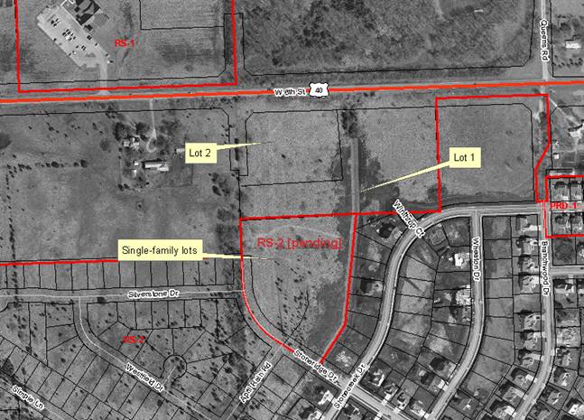
Reviews of the subject property have previously considered the east and west half of the property as separate parcels generally divided by the drainage easement. The Final Plat (Stoneridge East) combined the two lots shown in the Preliminary Plat and acted upon as a single entity with the rezoning to a Planned Unit Development. The Planning Commission discussion of the rezoning suggested the western portion of the subject property as appropriate for higher density (15 dwelling units per acre) and the eastern portion lower density.
Approval of the RS-2 (Single-Family Residence) District zoning for this part of the property (originally included a request to the south area zoned for single-family detached lots) included discussion by both the Planning Commission and the City Commission concerning transition within the development, density and stormwater run-off.
STAFF ANALYSIS
The property is generally located on the southeast corner of W. 6th Street and Stoneridge Drive. The proposed Preliminary Development Plan for multi-family apartments has been evaluated based upon the following suggested findings of fact and conclusions outlined in Section 20-1010.1 of the Zoning Ordinance for the City of Lawrence.
1) In what respects the plan is or is not in general conformity with the provisions of the Comprehensive Plan of the City.
The Comprehensive Plan, Horizon 2020 recommends infill development over annexation of new residential areas. The Plan also recommends a mixture of housing types, styles and economic levels for new development in a compatible density arrangement. The proposed request is intended to represent a medium density development consistent with the definition of medium density found in Horizon 2020 between 7 to 15 dwelling units per acre (Page 5-3). The proposed Preliminary Development Plan notes density at 11.96 dwelling units per acre. This calculation does not account for the full area of the drainage easement that bisects the site and is actually 13 dwelling units per acre. While this is a moderate density per Horizon 2020 it is not consistent with the zoning restriction of a maximum of 12 dwelling units per acre set for the site at the time of rezoning approval. The proposed development exceeds the allowable number of units as shown in the summary table. A new Development Plan must be submitted to address the maximum density permitted based on standard use of the definition of net area found in section 20-1007 (a).
Horizon 2020 expands the definition of medium density residential development and states: “medium density residential areas are intended to promote a mix of housing types within planned development areas.” Development is intended to include a mix of single-family detached and attached homes, cluster homes, townhomes, and similar housing types. Development is recommended to avoid concentrations of same housing type. Horizon 2020 also states that medium density residential development “should be designed to help avoid major and abrupt changes in density or use” (Page 5-4).
Horizon 2020 identifies the specific elements to be considered in development proposals and compatibility to include: use, building type, density, intensity of use, architectural style, scale, access, relationship to the neighborhood, and amount and treatment of screening and open space, with respect to location criteria. The land use zoning was approve for medium density residential development as a Planned Residential Development and limited the density to a maximum of 12 dwelling units per acre and maximum building height of two stories (Residential Goal 1, Policy 1.1(a)).
Careful attention to transition areas is recommended by Horizon 2020, but is not addressed in the proposed Preliminary Development Plan along the south side of the development as demonstrated by the placement of 8-plex and buildings abutting single-family lots (ref. Residential Policy 1.1(b)).
The proposed plan was revised to address and provide incorporation of certain design elements such as the drainageway and interior pedestrian connections. These are important element of the project and the effort made to incorporate these design elements should be recognized.
Staff Finding – The proposed development is a medium density development that exceeds the approved density cap for the zoning district. The proposed development does not address land use transition within the development between the arterial street to the north and the single-family lots to the south.
2) In what respects the plan is or is not consistent with the Statement of Objectives of Planned Unit Development. [The statement of objectives of planned unit developments is found in Section 20-1002 of the Zoning Ordinance]
(1) To promote and permit flexibility that will encourage innovative and imaginative approaches in residential, commercial, and industrial development which will result in a more efficient, aesthetic, desirable and economic use of the land while maintaining density and intensity of use consistent with the adopted Comprehensive Plan for the City;
The proposed development includes two residential building types accommodating one and two bedroom units within two building types of a similar shape and form. The approval of the zoning district limits the development to a maximum of two stories.
(2) To promote development within the City that can be conveniently, efficiently and economically served by existing municipal utilities and services or by their logical extension;
Extensions of water and sanitary sewer service were found to be available to the property as part of the subdivision review.
(3) To promote design flexibility including placement of buildings, and use of open space, pedestrian and vehicular circulation facilities to and through the site, and off-street parking areas in a manner that will best utilize potential on-site characteristics such as topography, geology, geography, size or proximity;
The proposed development includes all 8-plex units, surface parking, garages and a combined clubhouse/pool facility and two studio units above the clubhouse.
(4) To provide for the preservation of historic or natural features where they are shown to be in the public's best interest including but not limited to such features as: drainageways, floodplains, existing topography or rock outcroppings, unique areas of vegetation, historic landmarks or structures.
The subject property is divided into an east and west half by a drainage channel, contained within a 40’ wide drainage easement, and includes both vehicle and pedestrian crossings connecting the two sides. No special approval of the crossings of the drainage easement is required from state or local regulatory agencies for the structures. The property also includes substantial grade changes across the site from both the south to the north and from the east to the west. Retaining walls are used along W. 6th Street and on the east side to enable the creation of building pads within the development. The natural topography slopes increase as you move to the north and east. This results in the base grade level being about 10’ higher then the abutting single-family lots to the south. Buildings are oriented around the perimeter of the site with off-street parking provided interior to the development.
Staff Finding – This finding requires a review of the physical aspects of the development as they relate to the topography and the surrounding area and asks for flexibility, convenience, and preservation/incorporation of natural features. The proposed Preliminary Development Plan clearly provides the inclusion of the drainageway into the development and makes it a part of the interior pedestrian circulation of the development. The proposed development however, is a single use type development using a variation of a single building type to accommodate both one and two bedroom apartments. The use of the building type provides uniformity within the development but does not provide land use transition between or integration with the abutting undeveloped lots and developed single-family homes which make up the majority of the surrounding neighborhood.
3) The nature and extent of the common open space in the Planned Unit Development, the reliability of the proposals for maintenance and conservation of the common open space, and the adequacy or inadequacy of the amount and function of the common open space in terms of the densities and dwelling types proposed in the plan.
The proposed development provides the required amount of open space within the development (5.05 acres) with over 50% of the site is open space. These areas are found around the perimeter of the site and include the drainageway in the center, two detention ponds at the south end and a common area on the west side. Smaller green spaces or open space areas are also located on the southwest and southeast corners of the site. The area along the north side of the site represents a significant slope, permanent easement and is part of the W. 6th Street gateway corridor. This area is not reasonable to provide pedestrian access to W. 6th Street except along the public street.
The large common area in the center part of the west side of the development is hidden by buildings on the east and west ends and by garages on the north end. Sidewalks and some surface parking lots provide access and exposure to this area. A similar element is not provided on the east side, however pedestrian connections over the drainage easement allow for accessibility to the area.
The proposed Preliminary Development Plan includes a clubhouse/pool with two studio units on the south side of the development. The placement of the clubhouse in the central portion of the west side would provide a more integrated use of the open space and clubhouse for residents of the development rather than the location on the south end. An optional location of the clubhouse placement could be in the southeast corner providing a common recreation element on the east side of the development and the use of the clubhouse as a transition element could be weighted with orientation of the pool on the inside of the development rather than the periphery. This would be consistent with a recommended residential design standards found in Horizon 2020 regarding screening a buffering for medium density development (Policy 2.3(b) Page 5-23). This would also provide transition between the church property (undeveloped) to the east and the proposed residential development.
There are no notes on the face of the proposed Preliminary Development Plan regarding the maintenance and conservation of open space within the development. This element could be conditioned and will also be addressed as part of the Final Development Plan review process (execution of necessary covenants and restrictions (20-10101(16), (17), and (18)). The proposed development is designed as an apartment complex and is not intended or appropriate for individual ownership.
Staff Finding –The proposed preliminary development plan exceeds the requirement of open space. Staff has noted specific elements that should be addressed to comply with the intent for the providing of access to common usable areas. Much of the open area provided is encumbered with easement, drainage/detention purposes or steep slopes. Additionally, the provision of specific notes as required for Preliminary Development Plans is lacking but is technical in nature.
4) Whether the plan does or does not make adequate provisions for public services, provide adequate control over vehicular traffic, and further the amenities of light and air, recreation and visual enjoyment.
Access to the site is provided from Stoneridge Drive (a collector street) and from Stonecreek Drive (a local street). Interior access within the site accommodates access to the buildings and to off-street and garage parking. This access to Stonecreek was specifically discussed by the Planning Commission and the City Commission. The concluding action on the Final Plat was the approval of vacation of right-of-way for the stub street from Stonecreek Drive. The City Commission stated expressly that the entirety of the right-of-way would be vacated. The east half of the right-of-way vacation went to the applicant. The balance of the right-of-way would be dedicated or released to the abutting residential property owner (the Final Plat has not been recorded). The proposed Preliminary Development Plan shows the access of the development tying into the existing street stub.
If fully vacated the applicant’s burden would be to place any access (if approved) fully on their own property thus making the drive shift more to the east.
Given the size of the development and number of dwelling units secondary access is appropriate. Therefore, staff does not support the vacation of the right-of-way and necessary agreements and design must be provided to manage the continuance of a public street into a private driveway. The Plan as proposed does not address maintenance of the remainder of the right-of-way, transition from a public street into a private driveway or mitigation of cut-through traffic.
Staff Finding – A Planned Unit Development is required to provide access to a collector street. The proposed development complies with this criterion. Off-street parking and interior access accommodate the use per city standards. Utilities can be extended to serve the site. Use of recreation areas are provided but are not visible from some areas within the development and do not meet other recommended provisions as discussed above.
5) Whether the plan will or will not have a substantial adverse effect on adjacent property and the development or conservation of the neighborhood area.
A portion of the south side of the subject property abuts single-family lots that are also under the same ownership as the subject property. They are not developed at this time. The eastern half of the subject property abuts developed single-family homes, public street right-of-way and undeveloped property to the east owned by a church.
The subject property abuts W. 6th Street and includes a required 50’ setback. This area will be required to be landscaped. The plan indicates retaining walls up to 3’ in height within the W. 6th Street setback and eastern peripheral setback areas. The plan was revised to reduce the overall height of the retaining walls to comply with the maximum 3’ limitation. The subject property generally sits at a lower elevation that the adjacent roadway of W. 6th Street. The property is also higher than the residential lots to the south. Building height is comparable within approximately 10’ of existing two story homes in the neighborhood.
Horizon 2020 recommends the provision of housing choices within neighborhoods and the overall density of 12 dwelling units per acre was approved for this property. However, the proposed development does not provide land use transition within the development, but attempts to address unlike land uses through buffering and building orientation.
Staff Finding –The proposed Preliminary Development Plan does not address land use transition within the boundaries of the property and will not benefit the surrounding developed and undeveloped single-family portion of the neighborhood.
6) In what respects the plan is or is not in conformance with the development standards and criteria of this article. [The general standards are found in Section 20-1006 and Preliminary Development Plan requirements are listed in Section 20-1010]
As discussed above the provision of common open space and density is not fully addressed by the proposed Preliminary Development Plan (20-1006(g)). Phasing of the development is not stated therefore it is expected that this is a single phase development. It is unlikely however that all buildings will be constructed prior to requests for occupancy. Minimum phasing information should be provided per 20-1010 (13). This information may be shown as a separate document or addressed with general notes on the face of a plan.
Staff noted specific notes that are required but not provided regarding provision for maintenance of common open space (20-1010 (16-18)).
Staff Finding - The Preliminary Development Plan could be conditioned to address these technical issues. However, given the other concerns about access, density, and transition, staff recommends denial of the development and resubmission to address these elements.
7) In what respects the plan is or is not in compliance with the requirements for application for tentative approval of the Planned Unit Development. [This finding refers to Section 20-1005 of the Zoning Ordinance.]
(a) A plan that is consistent with (1) the "Statement of Objectives for Planned Unit Development," (2) the adopted Comprehensive Plan of the City, (3) the development standards set out herein, and (4) any specific rules and regulations for Planned Unit Developments adopted from time to time by the planning commission and city commission and placed on public record in the office of the city clerk shall be deemed to be qualified for tentative approval. No such rules and regulations shall be revised or added to so as to be applicable to a specific proposal for a Planned Unit Development after an application for tentative approval has been filed by the landowner or his or her agents.
(b) A plan shall be consistent with the following standards for the use, type, bulk, design and location of buildings, the density or intensity of use, the common open space, the public facilities and the development by geographic division of the tract.
Staff Finding –As discussed above the proposed development does not fully comply with all elements found in the statement of objectives nor the comprehensive plan and several specific provisions required for Preliminary Development Plans.
8) The sufficiency of the terms and conditions proposed to protect the interest of the public and the residents of the Planned Unit Development in the case of a plan that proposes development over a period of years.
The proposed development is shown as a single project and does not include phasing. This element will be confirmed with the Final Development Plan. Access to W. 6th Street is recommended as a condition of approval prior to occupancy of the development. Vehicular circulation during the construction of the project will require additional discussion to mitigate access to the adjacent local street. It is not anticipated that total removal of construction traffic can be maintained during actual development.
Notes must be added to articulate that the drainage improvements, detention ponds, interior access improvements must be installed prior to release of occupancy of individual buildings.
Staff Finding –The proposed Preliminary Development Plan does not include necessary notes to clarify the development intention.
9) Stormwater detention calculations and storage of excess stormwater drainage as per City Policy.
Staff Finding – A stormwater study was provided with the application and was reviewed and accepted by the Public Works Staff. The proposed development includes a 40’ by 525’ drainage easement and two detention ponds.
Note: Area residents are meeting with City Public Works Staff on Monday afternoon to discuss stormwater runoff for the neighborhood. Planning Staff is not a participant in this meeting. Staff will provide an update if possible to the Planning Commission at the meeting.
Staff Review
The subject property is located on the south side of W. 6th Street and on the east side of Stoneridge Drive in the West Lawrence Neighborhood. The property is divided into an east and west side by a significant drainage easement. The proposed development attempts to unite these two sides with a vehicular/pedestrian bridge crossing on the north end and a separate pedestrian bridge further to the south. The subject property is also abutted by proposed single-family lots as part of the Final Plat that also includes the subject property. These single-family lots are not platted yet and are under the same ownership as the proposed development. Key development concerns in this project are:
· Density – Maximum density is set at 12 dwelling units per acre. Allowance of a higher density on the west side might allow for a different or more integrated development. Options include separating the development into an east and west side. Implementation of a much lower impact development on the east side and substantial implementation of buffer treatment on the south side of the west portion.
· Transition- Provision of land use transition within the site is required to address both the north to south orientation as well as east to west orientation. Buffer techniques are used when incompatible or unlike land uses abut without the provision of a transition zone. Techniques include berms, fencing, landscape screening and building separation. Land use transition is the layering of land uses from more intensive to less intensive in increasingly restricting manner. Conventional applications include progressively restrictive zoning such as commercial, multi-family, duplex and single-family development from an arterial street down to a local street level. The plan could be revised to include smaller buildings (duplex and triplex units) adjacent to the single-family homes along the south side of the property.
· Access – secondary access was noted in the staff discussion with both the Planning Commission and the City Commission. It was acknowledged that dependant upon the type and intensity of development, in terms of the total number of dwelling units, secondary access would be recommended for minimum emergency/safety access. Fire/Medical staff has indicated that secondary access from Stonecreek Drive is required unless all structures east of the drainageway are constructed with fire sprinkler systems.
Rights-of-way
Additional right-of-way is not required as part of the Preliminary Development Plan. Easements and Right-of-way are included in the dedication of the Final Plat as approved by both the Planning and City Commissions. Adequate right-of-way is provided for this intersection for the proposed development.
City Staff and KDOT personnel have indicated concern that the intersection of W. 6th Street and Stoneridge Drive will need geometric improvements in the future based on traffic growth from W. 6th Street and development to the north. Placement of traffic signals and turn lanes may be needed resulting in future intersection improvements for the W. 6th Street/Stoneridge Drive intersection. Staff does not anticipate the need for additional right-of-way.
The immediate intersection improvements must be completed prior to occupancy of any portion of the development. Development of this property should be made subject to agreement to participate in future intersection and signal improvements.
Secondary access is proposed from Stonecreek Drive, a local street on the southeast portion of the development. The proposed development ties directly into a public street with no adjustment for the provisions of vacation as were approved on the final plat. There is no distinction between the public and private street/access and the maintenance responsibility of such access has not been addressed.
Staff has identified several options to address Stonecreek Drive each has both positive and negative attributes.
1. Removal of the access to Stonecreek. This option would eliminate secondary access and prevent any connectivity with the neighborhood except for the access on the west side of the development. Access to the east side for emergency services require the use of an internal bridge structure and would require the sprinkling of the buildings for fire safety.
a. Vacation of Right-of-way ½ going to the applicant the other half going to the adjacent property owner.
b. Replacement of easement to cover utilities within the existing right-of-way would be required.
c. There are existing storm sewer inlets within the existing street stub that would need to be addressed.
d. Assignment of responsibility for removal of street stub would be required.
e. Extension of curb along Stonecreek Drive would need to be constructed.
2. Reconstruction of access to Stonecreek. This option would require the placement of the access drive from the development in a shifted location further to the east along Stonecreek Drive fully on the applicant’s property.
a. Vacation of Right-of-way ½ going to the applicant the other half going to the adjacent property owner.
b. Replacement of easement to cover utilities within the existing right-of-way would be required.
c. There are existing storm sewer inlets within the existing street stub that would need to be addressed.
d. Assignment of responsibility for removal of street stub would be required.
e. Extension of curb along Stonecreek Drive would need to be constructed.
3. Allowance of curb cut as proposed to remain as tie into existing street right-of-way (assumes vacation of right-of-way is included for only eastern half of stub street).
a. Placement of speed hump and signage to state end of public maintenance and discourage cut through traffic
b. Placement of lockable gate or opticom sensors to prevent access other than emergency services.
c. Execution of agreement for maintenance and use of remaining un-vacated right-of-way.
4. Allowance of curb cut as proposed and assumes full vacation of right-of-way where developer must secure agreement for use or ownership of western half of right-of-way from abutting property owner.
a. Placement of speed hump and signage to state end of public maintenance and discourage cut through traffic
b. Placement of lockable gate or opticom sensors to prevent access other than emergency services.
c. Execution of agreement for maintenance and use of remaining un-vacated right-of-way.
As demonstrated several elements must be resolved prior to any approval for access to Stonecreek Drive from Winthrop Court (the existing stub street).
For the number of units, secondary access is recommended both for traffic and for emergency services purposes. The existence of the drainage crossing is especially a concern for fire safety access to the east side of the development resulting in a requirement that all building would need to be sprinkled. Vacation or partial vacation of the right-of-way must address the presence and relocation of existing utilities and maintenance/use of right-of-way.
Use Restrictions
The property is zoned for Planned Residential Development (pending approval of Preliminary Development Plan) subject to two restrictions. The building height was limited to two stories, but no additional height description was added. The density of the development was restricted to a maximum of 12 dwelling units per acre by the City Commission.
Building Orientation
The proposed buildings provide a back to back relationship to the surrounding area and are oriented to the center parking areas. Buildings are generally located adjacent to the minimum setback requirement for a PRD of 35’ on the south side of the development buildings are oriented with the building length facing the abutting residential lots with the exception of the clubhouse and one unit set on the diagonal to the existing developed residential lot on Stonecreek Drive. However these two buildings are also immediately adjacent to drainage easements within increases the separation between the two uses.
Section 21-1006(j) states “If topographical or other barriers within 35 feet of the boundaries of the Planned Unit Development do not provide reasonable privacy for existing uses adjacent to the development, the planning commission shall impose either of the following requirements or both;
1. Structures located along the boundary must be setback from the boundary a distance which is approved by the commission; and
2. Structures located along the boundary must be well screened in a manner which is approved by the Commission.
The discussion of the rezoning requests did not clarify how transition would occur within the subject property. Staff recommends the Planning Commission provide direction on this design element.
Garage units are used on the east and west ends and will provide screening to some degree in those areas. The undeveloped area to the north is at a higher elevation. The property abuts public right-of-way on the west side and additional landscaping will be appropriate in that area.
As discussed previously the common open space on the west side in the central portion of the development is largely hidden by garage and building faces. The interior sidewalk was revised to provide a more direct connection to this area from the north side. Smaller buildings in this location are more appropriate to allow more visibility of the area.
Closing
Specific direction from the Commission is requested with regard to the provision of access to Stonecreek Drive based on an actual development proposal. Clarification of the intent of the PRD zoning is also required for both staff and the applicant as to the transition elements, variety of building types and use of buffer treatments to be incorporated into a development proposal for the subject property as it relates to the surrounding single-family neighborhood.